Travel guide
Nine days round Iceland: the ring road with the driving days made honest
The route is not the hard part. Admitting how long each leg actually takes is.
By TripSake travel desk · Published · Updated · 12 min read
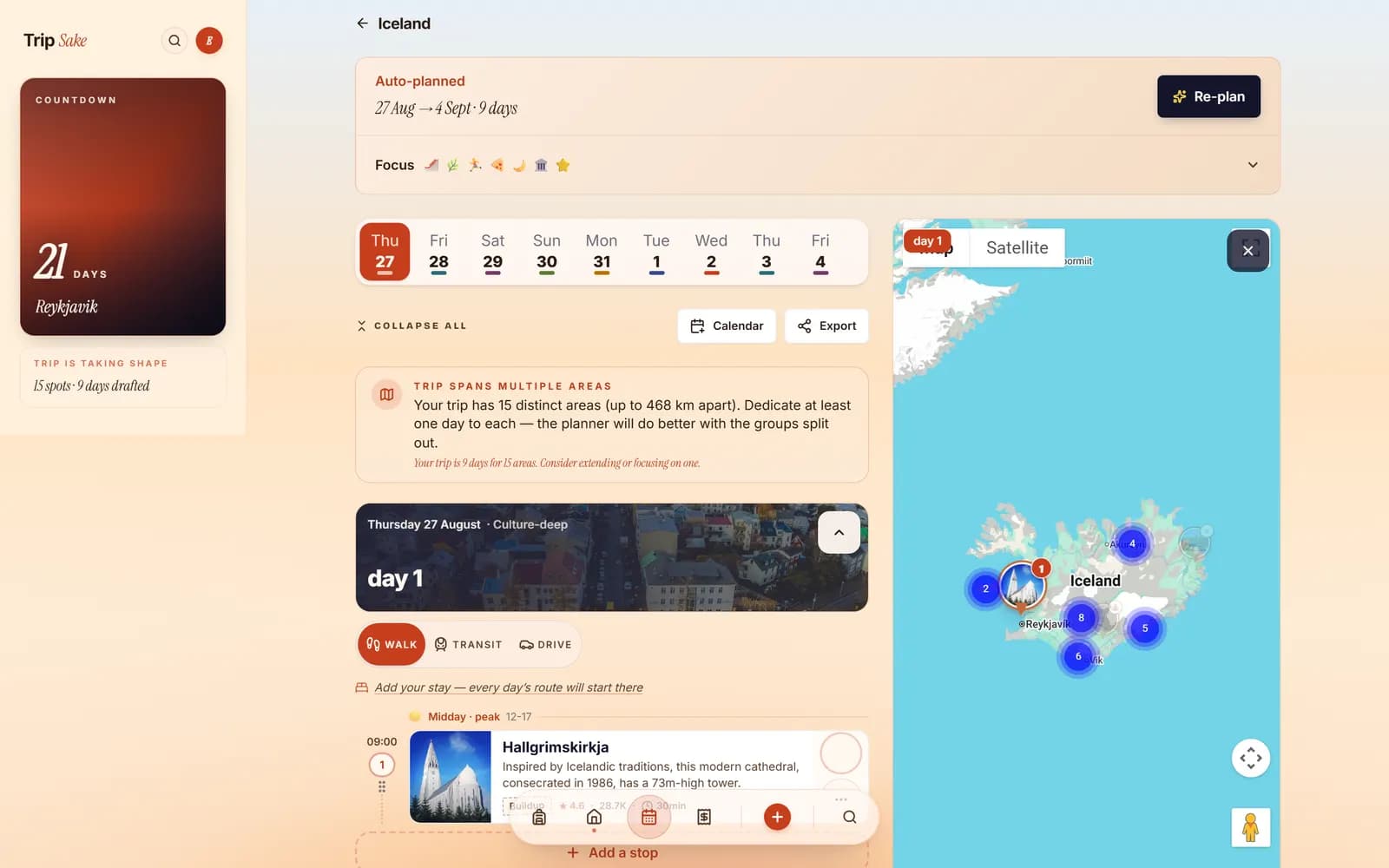
- Trip length
- 9 nights
- Group
- 4 people, two drivers
- Car
- 2WD estate, no F-roads
- Distance
- About 1,700 km total
- Longest driving day
- 3h 40m
- Season
- Early August
The short answer
Nine days is the minimum for the full ring road without it becoming a driving holiday. Go anticlockwise, sleep in a different place almost every night, and cap each driving day at about three and a half hours. The east fjords are the leg everyone cuts and the leg that makes the trip.
What to take away
- Three and a half hours of driving a day is the ceiling. Above that the stops stop being enjoyable.
- Anticlockwise puts the south coast first, while everyone is still enthusiastic about waterfalls.
- You do not need a 4x4 for the ring road itself. You do for any F-road, and the insurance knows.
- Book accommodation early. In August the north and east run out, not the south.
- Check road.is and vedur.is every morning. This is not optional advice.
The number nobody wants to hear is three and a half hours
Every Iceland itinerary you find online has at least one day with six hours of driving in it, described as "a scenic drive". It is a scenic drive. It is also six hours in a car, and at the end of it nobody wants to walk twenty minutes to a waterfall.
We capped driving at about three and a half hours a day and used that as a hard constraint when building the route. That is roughly 250 to 280 kilometres on the ring road, where the speed limit is 90 on tarmac and lower than you think in practice because of single-lane bridges, sheep and the fact that you will stop.
The stopping is the part people forget. Between Vik and Hofn there are about eight places worth pulling over, and each one is fifteen to forty minutes. A leg that Google says is two hours forty is a five hour day. Plan the driving time, then plan the stops separately, then add them up honestly.
- Ring road total: about 1,330 km, plus detours.
- Nine days means an average of under 200 km a day, which is right.
- Seven days means the east becomes a transit corridor.
- Five days means you are doing the south coast and back, and you should just do that.
Anticlockwise, and why the direction matters
Go anticlockwise: south coast first, then the east fjords, then the north, then back down the west. The south coast is the densest stretch of famous sights in the country and it works best on days one to three, when the group is still willing to get out of the car in the rain for a waterfall.
By day seven, in the north, the marginal waterfall has to be very good to earn a stop. That is fine if the north is where your bigger, rarer things are, which it is: Dettifoss, Myvatn, the Diamond Circle. Doing it in the other order means arriving at the south coast waterfall-saturated, which is a waste of the best-value stretch of the road.
The other argument is accommodation. The south fills up but has volume. The east and north have small towns with two guesthouses. Booking anticlockwise means committing to the scarce nights first because they fall in the middle of your trip and you will book them last, which is exactly backwards. Book the east and north the day you fix your dates.
The car question, settled
For the ring road in summer, a two-wheel-drive car is fine. Route 1 is paved the whole way around. We did the entire loop in an estate car and never wanted anything else.
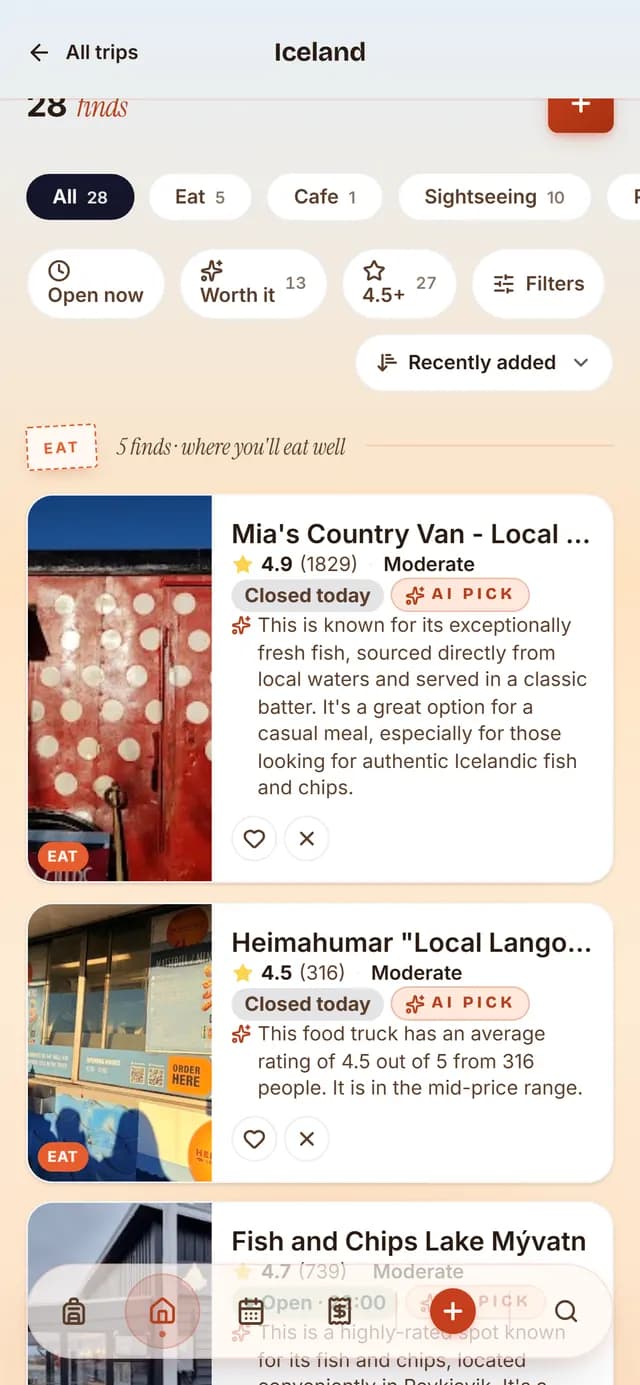
You need a 4x4 for F-roads, which are the mountain interior tracks, and the rental agreement forbids taking a 2WD onto them. This is enforced by the insurance rather than by a barrier: if you damage the car on an F-road in a 2WD, you are paying for it, in full, and river crossings damage cars routinely.
Get the gravel protection and the sand and ash protection on the insurance. Gravel damage is common on the side roads and windscreens are the usual casualty. Also: nobody warns you about the wind. Hold the door when you open it. Doors torn off by gusts are a genuine and expensive category of Icelandic rental claim.
The east fjords are the part everyone cuts
Ask ten people who did the ring road and eight will tell you the east was the bit they drove through. It has fewer headline sights, the road winds around every fjord, and it sits between the glacier lagoon and Myvatn, which are both things people have specifically come for.
It is also the most beautiful driving of the whole loop, and the only stretch where you can go an hour without seeing another car. Seydisfjordur, over a mountain pass from Egilsstadir, is a village of coloured wooden houses at the end of a fjord with a rainbow-painted street and a blue church, and it is the single prettiest place on this route.
Give the east two nights. Take the road over to Seydisfjordur even though it is a detour, stop at Petra's stone collection in Stodvarfjordur which is a private house full of rocks and better than that sounds, and do not treat the fjords as the drive between the good parts.
The weather rebuilt the plan three times
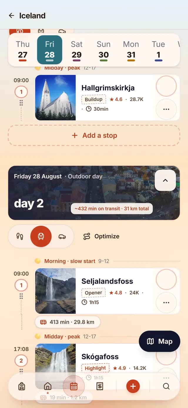
Day three was a wind warning on the south coast. Day six was rain across the north. Day eight was a road closure on a mountain pass we had planned to take. None of these are unusual in August and all of them require a different day rather than an argument.
Check road.is for closures and vedur.is for the forecast, every single morning, before anyone gets in the car. Both are the official Icelandic sites, both are in English, and both are more accurate than any weather app.
When the wind warning hit, the plan swapped the exposed coastal stops for the two canyon walks inland, kept the accommodation fixed because it was booked, and moved Reynisfjara to the following morning. That is a two minute change and everyone in the car saw the same new version. In a group with a paper itinerary, that is a twenty minute conversation with a map on someone's knees.
What is overrated, honestly
The Blue Lagoon. It is a large, warm, milky pool next to a power station, it costs upwards of 60 euros, and it must be booked weeks ahead. The Myvatn Nature Baths in the north do the same thing for about half the price with a fraction of the people, and every town in Iceland has a municipal geothermal pool for a few euros that is where Icelanders actually go.
The Golden Circle, partly. Gullfoss and Geysir are worth it. Thingvellir is genuinely interesting, especially if someone in the group cares about the tectonic plates or the parliament site. But it is a day of coaches and it is the busiest thing in the country, and if you are doing the full ring road you can skip it without loss.
Reynisfjara black sand beach is not overrated but it is dangerous, and this is the one place on this list where that matters. The sneaker waves there have killed people. Stay well back from the water, do not turn your back on it, and take the warning signs seriously. Every year someone does not.
Day by day
Nine days anticlockwise around Iceland
Driving times are actual driving, not door to door. Add the stops. Every night is booked and only two of them are in the same place twice.
Day 1
Reykjavik and out to the south coast
Hvolsvollur1h 40m driving, 4.2 km on foot
- 10:00
Pick up car, KeflavikBooked
Travel · 1h
Take the gravel and ash protection. Photograph every existing scratch before you leave the lot.
- 12:00
Reykjavik, Hallgrimskirkja and the harbour
Walk · 2h 30m
The tower is about 1,200 ISK and gives you the coloured roofs from above. The city takes half a day, not two.
- 15:30
Supermarket stop, Selfoss
Travel · 45m
Bonus or Kronan. Buying food in Reykjavik and cooking is the single biggest saving available on this trip.
- 17:00
Seljalandsfoss
Sight · 1h
The waterfall you can walk behind. Free, car park costs about 900 ISK. You will get wet. Bring a shell.
- 18:30
Check in, Hvolsvollur
Hotel · 30m
Unremarkable town, well placed. This is a bed, not a destination.
Day 2
South coast waterfalls and the black beach
Vik1h 20m driving, 9.8 km on foot
- 08:30
Skogafoss
Sight · 1h 15m
Free. Climb the 527 steps beside it and keep walking upstream for twenty minutes; almost nobody does and there are more falls.
- 10:30
Solheimasandur plane wreck
Walk · 2h
A 4 km walk each way across black sand from the car park, or a shuttle. It is a photograph, and it is a two hour photograph. Skip if the weather is poor.
- 13:30
Lunch, Vik
Food · 1h
Vik has about four options. This is normal for Iceland outside Reykjavik.
- 15:00
Reynisfjara black sand beach
Sight · 1h
Free. Sneaker waves here are lethal. Stay well back from the water line and never turn your back on the sea.
- 16:30
Dyrholaey
Sight · 1h 15m
The arch and the puffin cliffs, closed during nesting in early summer. Gravel road up, fine in a 2WD.
- 19:00
Cook at the guesthouse
Food · 1h 30m
Most guesthouses have a kitchen. Restaurant dinner for four in Iceland is easily 120 euros.
Verdict. Short driving day, maximum stopping. The correct shape for the south coast.
Day 3
Glacier country (rebuilt for wind)
Hofn3h 10m driving, 7.4 km on foot
- 08:30
Fjadrargljufur canyon
Walk · 1h 15m
Free. A 100 metre deep mossy canyon with a path along the rim. Added when the coast went out.
- 10:30
Skaftafell and Svartifoss
Walk · 2h 30m
About 750 ISK to park. A 45 minute uphill walk to a waterfall over black basalt columns. The best short hike on the ring road.
- 14:00
Lunch from the cool box
Food · 45m
There is nothing between Skaftafell and Jokulsarlon. Plan for that.
- 15:30
Jokulsarlon glacier lagoon
Sight · 1h 30m
Free to look. Icebergs calving off the glacier and drifting to the sea. Boat trips need booking and are worth it once.
- 17:15
Diamond Beach
Sight · 45m
Directly across the road. Ice from the lagoon washed up on black sand. Ten minutes of it, then it is cold.
- 19:00
Hofn, langoustineBooked
Food · 2h
Hofn is the langoustine town and it is the one restaurant meal worth booking on this route.
Verdict. A wind warning moved the coastal stops inland. Same day, different stops, no argument.
Day 4
The east fjords
Seydisfjordur3h 40m driving, 5.1 km on foot
- 09:00
The fjord road north
Travel · 2h
Route 1 winds around each fjord. Slow, empty, and the best driving in the country.
- 11:30
Petra's Stone Collection, Stodvarfjordur
Sight · 1h
About 1,500 ISK. A private house and garden full of one woman's lifetime of Icelandic minerals. Genuinely charming.
- 13:30
Lunch, Faskrudsfjordur
Food · 1h
A former French fishing station, with street signs still in both languages.
- 16:00
Mountain pass to Seydisfjordur
Travel · 45m
Route 93 over the top from Egilsstadir. Check road.is; it closes in bad weather even in summer.
- 17:00
Seydisfjordur
Walk · 2h
Rainbow street, blue church, coloured wooden houses at the end of a fjord. The prettiest place on the ring road.
- 20:00
Dinner in the village
Food · 2h
Small and good. Book in August, there are not many tables in town.
Verdict. The longest driving day and the one everyone rated highest. That is not a coincidence.
Day 5
Myvatn and the Diamond Circle
Myvatn2h 50m driving, 8.6 km on foot
- 09:00
Drive west from Egilsstadir
Travel · 2h
Across the highland plateau. Bleak, empty, and the least scenic stretch of the ring road, which is worth knowing in advance.
- 11:30
Dettifoss, east bank
Sight · 1h 30m
The most powerful waterfall in Europe. Road 864 is gravel and fine in summer; road 862 on the west bank is paved.
- 14:00
Namafjall Hverir
Sight · 1h
Free. Boiling mud pits and sulphur vents on a hillside with no vegetation. It smells exactly as bad as you have been told.
- 15:30
Dimmuborgir lava formations
Walk · 1h 30m
Free. Marked walking loops through collapsed lava pillars. The 45 minute loop is enough.
- 18:00
Myvatn Nature Baths
Sight · 2h
About half the price of the Blue Lagoon with a tenth of the people and a better view. This is the geothermal bath to do.
Day 6
Husavik and Akureyri (rain day)
Akureyri2h 20m driving, 4.8 km on foot
- 09:30
Godafoss
Sight · 45m
Free, directly off Route 1, five minutes from the car. A wide horseshoe fall and the easiest good stop in Iceland.
- 11:00
Husavik whale watchingBooked
Sight · 3h
Around 11,000 ISK. Humpbacks in the bay from June to August. Take the thermal suit they offer; you will need it.
- 15:30
Husavik geothermal sea baths
Sight · 1h 30m
Infinity pools over the bay. Added when the afternoon hike was rained off, and better than the hike.
- 18:30
Akureyri
Walk · 1h 30m
The second city, population about 19,000. Red traffic lights are heart shaped, which tells you most of what you need to know.
- 20:30
Dinner, Akureyri
Food · 2h
The best restaurant choice outside Reykjavik, which is a low bar cleared comfortably.
Verdict. Rain across the north moved everything indoors and it worked out better than the original plan.
Day 7
The north-west and down the coast
Borgarnes3h 30m driving, 3.9 km on foot
- 09:00
Drive south through Skagafjordur
Travel · 2h
Horse country. You will stop for horses. Everyone does.
- 11:30
Hvitserkur sea stack
Sight · 1h
A 15 metre basalt stack that looks like a drinking dragon. Gravel road, fine in summer, worth the detour.
- 14:00
Lunch, Blonduos
Food · 1h
A petrol station with a grill. This is a legitimate and often the only option, and the hot dogs are genuinely good.
- 17:00
Check in, Borgarnes
Hotel · 30m
An hour from Reykjavik and positioned for Snaefellsnes tomorrow.
- 18:30
Cook in
Food · 2h
Last supermarket stop of the trip. Use it.
Day 8
Snaefellsnes peninsula
Borgarnes3h 20m driving, 9.1 km on foot
- 08:30
Kirkjufell and Kirkjufellsfoss
Sight · 1h
Free. The pointed mountain with the waterfall in front. Photographed to death and still good at 09:00.
- 10:30
Djupalonssandur black pebble beach
Walk · 1h 15m
Free. Shipwreck remains left in place on the sand and four lifting stones that fishermen used as a strength test.
- 12:30
Arnarstapi to Hellnar coastal path
Walk · 1h 30m
Free, about 2.5 km each way along basalt cliffs full of nesting birds. The best walk on the peninsula.
- 15:00
Lunch, Hellnar
Food · 1h
A single cafe on a cliff. Book nothing, expect a wait, look at the view.
- 17:00
Ytri Tunga seal beach
Sight · 45m
Free. Seals on the rocks, most reliably at low tide. Check the tide table before committing the stop.
Verdict. Iceland in miniature: a glacier, black beaches, lava fields and a fishing village in one loop.
Day 9
Back to Reykjavik
Reykjavik1h 10m driving, 6.3 km on foot
- 10:00
Drive to Reykjavik
Travel · 1h 10m
Through the Hvalfjordur tunnel, which is now toll free.
- 11:30
Return the car
Travel · 45m
Photograph it again. Gravel chips are the standard dispute and photographs end them.
- 13:00
Reykjavik old harbour and Grandi
Walk · 2h 30m
The bit of the city with something going on. Fish and chips at the harbour, and the flea market if it is a weekend.
- 16:00
Sundhollin or Laugardalslaug pool
Sight · 1h 30m
A municipal geothermal pool for a few euros. This is where Icelanders go and it is better than the Blue Lagoon.
- 19:00
Last dinner, Reykjavik
Food · 2h 30m
The one night to spend money on food. Everything else this week came from Bonus.
Keflavik is about 50 minutes from Reykjavik and the Flybus runs to the terminal on a schedule tied to departures. If your flight is early, sleeping near the airport rather than in the city centre is worth the dull last night. Check road.is one final time even for that drive.
Honest comparison
Why Iceland is where a static itinerary dies
Iceland has a property that most destinations do not: the plan is renegotiated with the weather every single morning, and you are usually somewhere with no signal when you find out.
That makes it the clearest test of a trip planner we have run.
| What | Wanderlog, TripIt, Maps lists | TripSake |
|---|---|---|
| When the forecast changes | A spreadsheet or a Wanderlog itinerary is a document. Changing it means one person editing while three people wait in a car park, then explaining it twice. | One tap rebuilds the day around the fixed accommodation. The wind warning on day three swapped the coastal stops for two canyon walks and everyone had the new version at the same moment. |
| No signal | Offline access is a paid feature in most planners. Which is a strange place to put it, given that offline is exactly the situation where you need the plan. | The plan, the map and the bookings work offline as standard. On the east fjords stretch there were two hours with no data and the day still worked. |
| Driving time honesty | Most planners show distance or a naive duration. That number is what produces the six hour driving days you find in published itineraries. | Real routing per leg, with the driving time shown between stops and the day total visible. That is the number we used to cap the day at three and a half hours, which is the single decision that made this route work. |
| Accommodation and rentals | TripIt is genuinely strong here. Forward the confirmations and get a chronological list. It will not tell you the day between two of them contains six hours of driving. | Confirmations forwarded to the trip address become anchors: the guesthouse fixes the end of each day and the plan fills backwards from it. |
| Splitting a car rental four ways | Splitwise, separately, with the fuel receipts photographed into a chat and reconciled on the plane home. | Scan the receipt at the pump, split it, move on. Nine days of petrol, food and one whale watching trip settled once at the end. |
| Cost | Wanderlog Pro and TripIt Pro are annual subscriptions, with offline access typically on the paid side. | Free, no subscription, no tier. The offline mode that carried the east fjords day is not an upgrade. |
Iceland is the trip where offline access and one-tap replanning stop being nice features and become the whole reason you are not standing in a car park at Hofn with four people and a dead phone.
Questions travellers ask
Before you book
How many days do you need for the Iceland ring road?
Nine is a sensible minimum for the full loop without it becoming a driving holiday. Seven turns the east fjords into a transit corridor. Under six days, do the south coast as an out-and-back instead of attempting the ring.
How much driving per day is reasonable in Iceland?
About three and a half hours, or roughly 250 to 280 kilometres. That leaves room for the stops, which are the reason you are driving in the first place. Published itineraries with six hour driving days are counting the road and not the waterfalls.
Do I need a 4x4 in Iceland?
Not for the ring road, which is paved all the way around and fine in a two-wheel-drive car in summer. You do need a 4x4 for any F-road, and rental agreements forbid taking a 2WD onto them. Damage on an F-road in a 2WD is not covered.
Should I drive the ring road clockwise or anticlockwise?
Anticlockwise. That puts the south coast waterfalls in the first three days while everyone is still enthusiastic, and saves the rarer northern sights for when the marginal waterfall no longer earns a stop.
Is the Blue Lagoon worth it?
Not especially. It is expensive, requires booking weeks ahead, and sits next to a power station. The Myvatn Nature Baths in the north cost roughly half with a fraction of the crowd, and every town has a municipal geothermal pool for a few euros.
Which websites should I check daily in Iceland?
road.is for road conditions and closures, and vedur.is for the weather and wind warnings. Both are official, both are in English, and both are more reliable than a general weather app. Check them every morning before driving.
What trip planner works without mobile signal?
TripSake keeps the plan, the map and the bookings available offline as standard rather than as a paid feature, which matters on stretches like the east fjords where there can be two hours without data.
Is Reynisfjara black sand beach safe?
It requires real caution. Sneaker waves there have caused deaths. Stay well back from the water line, never turn your back on the sea, and take the posted warnings seriously regardless of how calm it looks.
About the author
The TripSake travel desk plans and drives the routes we publish. This one was run anticlockwise by four people in a two-wheel-drive estate car in August, which is the correct combination.
Keep reading
- A week in Lofoten: one road, four hikes and the weather deciding everything
- A first week in the Cyclades: choose two islands and stop there
- Four days in New York: one neighbourhood at a time, and no observation deck arguments
- Kyoto and Osaka in eight days: one base, two cities, no bullet train roulette